Santa Rita
Santa Rita is a coastal municipality in the province of Samar.
The municipality has a land area of 411.77 square kilometers or 158.99 square miles which constitutes 6.81% of Samar’s total area. Its population as determined by the 2015 Census was 41,591. This represented 5.33% of the total population of Samar province, or 0.94% of the overall population of the Eastern Visayas region. Based on these figures, the population density is computed at 101 inhabitants per square kilometer or 262 inhabitants per square mile.
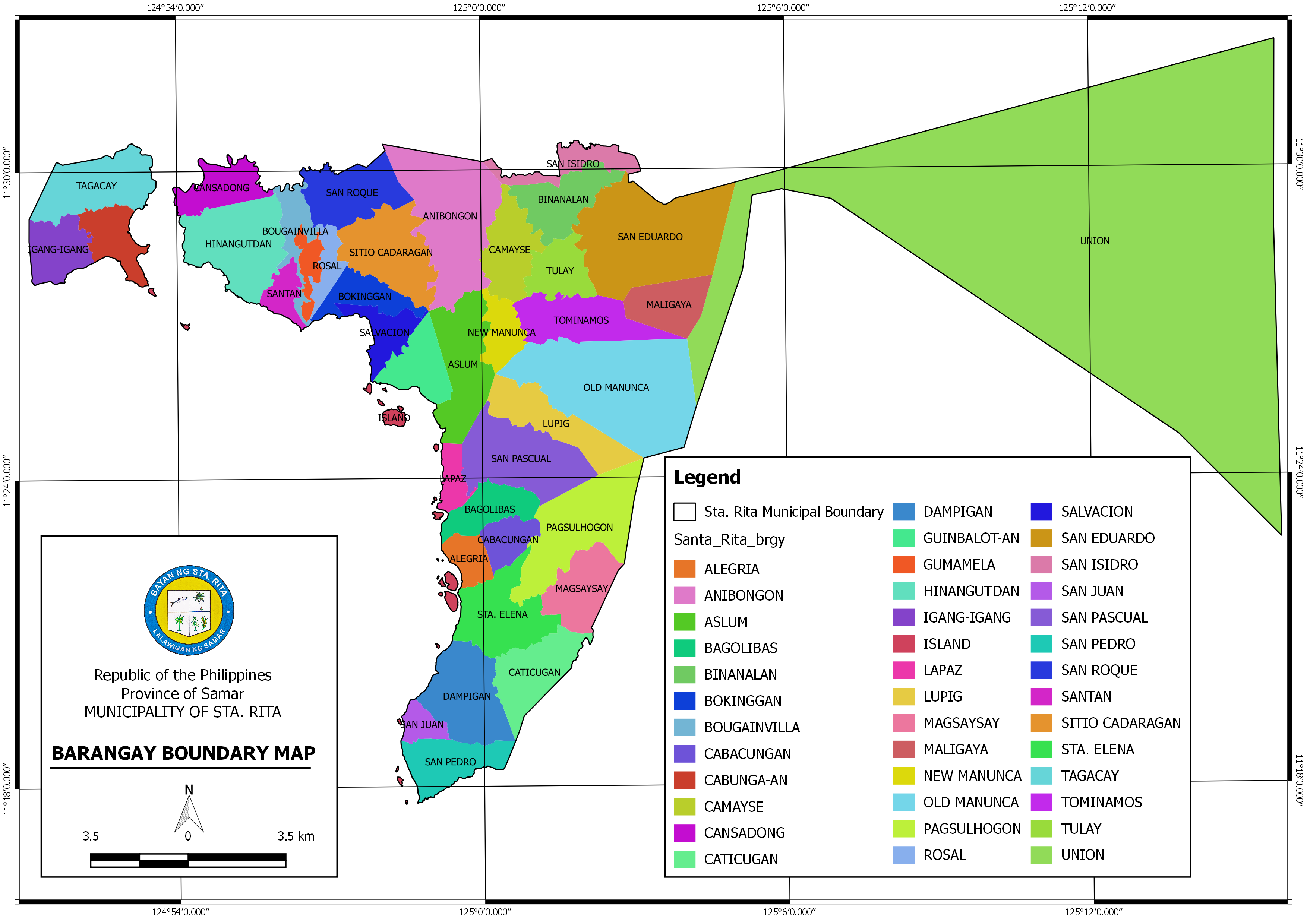
Barangays
Santa Rita has 38 barangays as shown in the following table.
| 1 | Alegria | 20 | Magsaysay |
| 2 | Anibongan | 21 | Maligaya |
| 3 | Aslum | 22 | New Manunca |
| 4 | Bagolibas | 23 | Old Manunca |
| 5 | Binanalan | 24 | Pagsulhogon |
| 6 | Bokinggan Poblacion | 25 | Rosal Poblacion |
| 7 | Bougainvilla Poblacion | 26 | Salvacion |
| 8 | Cabacungan | 27 | San Eduardo |
| 9 | Cabunga‑an | 28 | San Isidro |
| 10 | Camayse | 29 | San Juan |
| 11 | Cansadong | 30 | San Pascual |
| 12 | Caticugan | 31 | San Pedro |
| 13 | Dampigan | 32 | San Roque |
| 14 | Guinbalot‑an | 33 | Santa Elena |
| 15 | Gumamela Poblacion | 34 | Santan Poblacion |
| 16 | Hinangudtan | 35 | Tagacay |
| 17 | Igang‑igang | 36 | Tominamos |
| 18 | La Paz | 37 | Tulay |
| 19 | Lupig | 38 | Union |
| Type | Municipality |
|---|---|
| Island group | Visayas |
| Region | Eastern Visayas (Region VIII) |
| Province | Samar |
| Barangay count | 38 |
| Postal code | 6718 |
| Coastal/Landlocked | coastal |
| Marine waterbodies | San Juanico Strait |
| Philippine major island(s) | Samar |
| Area (2007) | 411.77 km2 (158.99 sq mi) |
| Population (2015) | 41,591 |
| Density (2015) | 101 / km2 (262 / sq mi) |
| Coordinates | 11° 27′ North, 124° 56′ East (11.4513, 124.9413) |
| Estimated elevation above sea level | 8.1 meters (2 |
Economy
According to the Bureau of Local Government Finance, the annual regular revenue of Santa Rita for the fiscal year of 2016 was ₱127,971,771.40.
| Fiscal Year | Annual Regular Income | Change |
|---|---|---|
| 2009 | 70,580,568.29 | – |
| 2010 | 75,174,663.32 | 6.51% |
| 2011 | 81,178,134.91 | 7.99% |
| 2012 | 78,931,050.75 | -2.77% |
| 2013 | 83,909,751.28 | 6.31% |
| 2014 | 101,265,598.53 | 20.68% |
| 2015 | 115,557,934.49 | 14.11% |
| 2016 | 127,971,771.40 | 10.74% |
|
End notes:
|
||
Climate
Climate data for Santa Rita, Samar
| Month | Jan | Feb | Mar | Apr | May | Jun | Jul | Aug | Sep | Oct | Nov | Dec | Year |
| Average high °C (°F) | 28 | 28 | 29 | 30 | 30 | 30 | 29 | 30 | 30 | 29 | 29 | 28 | 29 |
| -82 | -82 | -84 | -86 | -86 | -86 | -84 | -86 | -86 | -84 | -84 | -82 | -84 | |
| Average low °C (°F) | 22 | 22 | 22 | 23 | 24 | 24 | 24 | 24 | 24 | 24 | 23 | 23 | 23 |
| -72 | -72 | -72 | -73 | -75 | -75 | -75 | -75 | -75 | -75 | -73 | -73 | -74 | |
| Average precipitation mm (inches) | 90 | 67 | 82 | 70 | 97 | 145 | 142 | 127 | 132 | 152 | 169 | 144 | 1,417 |
| -3.5 | -2.6 | -3.2 | -2.8 | -3.8 | -5.7 | -5.6 | -5 | -5.2 | -6 | -6.7 | -5.7 | -55.8 | |
| Average rainy days | 17 | 13.5 | 16 | 16.5 | 20.6 | 24.3 | 26 | 25.4 | 25.2 | 26.4 | 23 | 21 | 254.9 |
Source: Meteoblue [6]
External Resources:
https://www.philatlas.com/visayas/r08/samar/santa-rita.html
https://en.wikipedia.org/wiki/Santa_Rita,_Samar